Wildfire risk is rising on Colorado’s Western Slope as strong El Niño is expected to bring monsoon rain in ‘spurts’
Colorado is expected to be at above-average wildfire risk starting in June and continuing through August, according to the National Interagency Fire Center


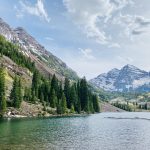
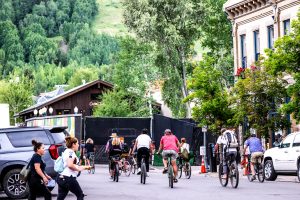
Austin Colbert/The Aspen Times
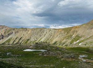
The wildfire risk on Colorado’s Western Slope is rising and expected to remain elevated throughout most of the summer after a winter with a record-low snowpack and well-above average temperatures.
AccuWeather Senior Forecaster Chad Merrill said Thursday, May 14, that the fire risk in the Colorado mountains is expected to increase heading into June and remain high into July but could be dampened slightly by cooler temperatures and monsoonal rain in August.
“We have much of Colorado at a high risk for wildfires this summer,” Merrill said. “What we have going on is a strong area of high pressure is going to push from the eastern U.S. in May back into the northwestern part of the country in June, and that’s going to instigate some very warm temperatures and some very dry weather.”
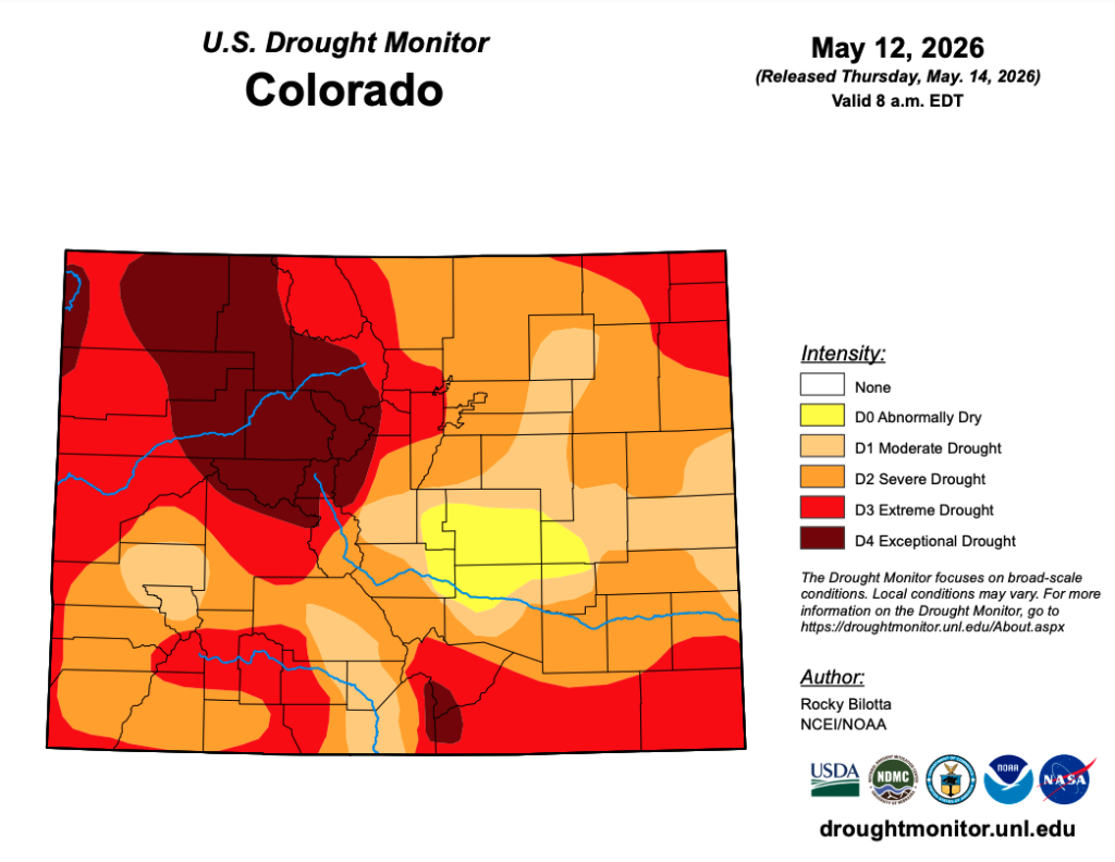
As a result of hot weather and low amounts of snow, Colorado is heading into summer with drought conditions across most of the state. Northwest Colorado is facing some of the most severe conditions. Summit, Grand, Pitkin, Routt, Garfield, Moffat and Rio Blanco counties are experiencing extreme, Level 3 of 4, or exceptional, Level 4 of 4, drought, according to the latest U.S. Drought Monitor map published on Thursday.
The National Interagency Fire Center’s wildland fire potential outlook published this month shows Colorado’s Western Slope at above-normal risk beginning in June and continuing through August.
The strong El Niño pattern that is developing over the Pacific Ocean is expected to “integrate with the atmosphere,” starting in June, Merrill said. While the El Niño, which is characterized by warmer-than-average sea surface temperatures, could help bring monsoonal rains to Colorado, he said it also brings the risk of lightning.
As the monsoon develops in late June and early July, Merrill said the dry ground throughout the mountains could suck the moisture from storms, creating the risk of dry lighting that could spark wildfires in drought-stricken terrain. Temperatures are expected to be at least 3 degrees above normal in June and 1-2 degrees above normal in July on the Western Slope, also elevating the fire risk, he said.
Precipitation is expected to be about normal this summer, and monsoonal rains could pick up in July and August, but storms will likely be inconsistent, with extended dry periods between them, Merrill said. August temperatures are also projected to be slightly below normal, helping to reduce the wildfire risk at least slightly, he said.
“The monsoon is going to come in spurts this year,” he said. “It’ll probably start a little bit earlier than July, in late June, but it’s going to come in ebbs and flows, where the monsoon moisture will come north, there will be enhanced rainfall from it, and then it will drop off for a couple of weeks and come back.”
Due to a high-pressure system that is expected to sit over the West and the jetstream created by the strong El Niño, Merrill said smoke from wildfires elsewhere in the country could be pushed north toward Canada this year. That could mean less smoke impacts for Colorado, especially south of the Interstate 70 corridor, he said.
Even if there is more monsoon moisture this fall than expected, he said Colorado’s drought is so intense that even above-average moisture wouldn’t be enough to pull parts of the state, like the northwest corner, out of drought. Most of Colorado needs 15 to 20 inches of rain to get completely out of drought, while an average monsoon season will deliver only between two to four inches of rain, he said.
As for next winter, he said that while it remains too far out for accurate forecasts, an El Niño pattern is typically associated with higher snowfall totals in the Rocky Mountains. But he warned that that isn’t always true for Colorado.
“Sometimes, it can split around Colorado a bit,” Merrill said. “… If you get one jetstream a little further south and one north, it can kind of bypass Colorado a bit and bring appreciable rain to the southwest but not so much Colorado. So that’s something to watch out for this winter.”
Pano AI camera ‘a priority’ for Independence Pass
Independence Pass is being set up for success this summer despite cuts to the U.S. Forest Service’s budget and staffing, with efforts to prioritize wildfire mitigation and response as well as secured funding in order to keep bathrooms open.

Sale, repair bikes not allowed in Aspen’s Right of Way
The city of Aspen’s Community Development and Engineering staff will communicate this spring to bike shops that for sale and repair fleets are not allowed in the Right of Way.