El Niño has officially arrived in Colorado, and stronger moisture could be next
Forecasters predict the current El Nino could turn into a “Super El Nino” by the end of the year, ranking it among the strongest ever recorded by the National Oceanic and Atmospheric Administration


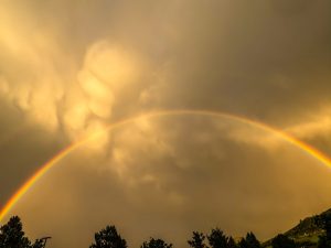
Chris Dillmann/Vail Daily archive
El Niño has officially arrived, bringing what could be one of the strongest El Nino summers the Northern Hemisphere has seen in decades.
El Niño conditions — characterized by above-average sea surface temperatures across the central to eastern equatorial Pacific Ocean — have been developing over the past month and were officially recognized by the U.S. National Oceanic and Atmospheric Administration on June 11.
The transition occurred rather quickly, OpenSnow Meteorologist Alan Smith noted in a June 16 report, as La Nina conditions — characterized by below-average sea temperatures — were present from January to March. Since then, sea surface temperatures have warmed rapidly.
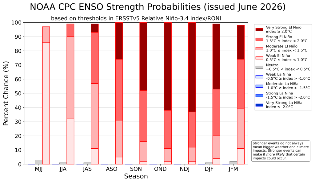
Now, forecasters predict the event could intensify into a “strong” or “super El Niño” by the end of the year. Based on recent sea surface temperature anomalies, the National Oceanic and Atmospheric Administration estimates the current El Niño has a 63% chance of reaching the highest strength threshold in the Northern Hemisphere sometime during winter, according to the June 11 advisory.
“In terms of the strength of this El Niño episode, the questions at this point really are whether or not this will be merely a ‘strong’ El Niño event or a ‘super’ El Niño event, and whether or not this will be a record-setting event as some models are projecting,” Smith wrote in the report.
Forecasters know El Niño conditions have arrived when sea surface temperatures reach an anomaly of at least 0.5 degrees Celcius. “Super El Niños” are classified by a sea surface temperature anomaly of greater than 2 degrees Celsius, while strong El Niños see anomalies between 1.5 and 2 degrees.
Were the anomaly to reach above 2 degrees Celcius, this El Niño would rank among the strongest events in the administration’s historical record going back to 1950. There have been three “Super El Niño” events since 1950, the most recent occurring between 2015 and 2016.
In the winter, El Niño typically contributes to above-average snow along both coasts and southern-tier states. The snowfall signal is less clear across the interior ski regions, including Colorado, Smith wrote, and requires a closer evaluation of strength and timing of El Niño’s phases.
While El Niño’s most dramatic weather effects typically occur in late fall and winter, its atmospheric setup increases the likelihood of higher precipitation, according to the National Oceanic and Atmospheric Administration. If forecasts are correct, Colorado — especially the Western Slope — could see a wetter-than-normal summer.
The Climate Prediction Center’s seasonal precipitation outlook continues to show above-average chances for rainfall in the western half of the state from July through September, according to estimates released June 18. The seasonal temperature outlook shows Colorado leaning toward a 45-50% chance of above-normal temperatures.
Although El Niño arrived with weak-to-moderate strength, it could still add more moisture to the promise of an active and fast-approaching monsoon season, typically ramping up in July. While a stronger El Niño doesn’t always translate directly to bigger weather impacts, it does increase their odds.
“There’s definitely some reason to believe that this monsoon season might be an active one right now … especially for Western Colorado,” said Peter Goble, assistant state climatologist at the Colorado Climate Center, in an interview with the Summit Daily in May. “Like almost anything in the forecast, that’s not a certainty, but it looks more promising than a normal summer.”
With Colorado’s statewide mountain snowpack officially hitting zero on June 10, the roughly 40% chance of above-average rainfall for the Western Slope could alleviate some of the fire risk as the region remains in the highest drought intensity, according to June 18 data from the U.S. Drought Monitor.
Short- and long-term forecasts
For now, the Four Corners region west of the Continental Divide remains in a drying trend, according to a June 19 mountain weather forecast from OpenSnow.
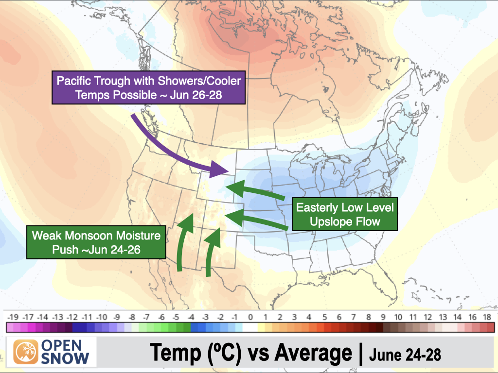
Over the next week, temperatures are expected to remain higher than average for Western Slope counties, while the Front Range and regions east of the Divide could see below-average temperatures.
On Saturday, June 20, the northern and central mountains can expect dry conditions and gusty winds, with a slight chance of thunderstorms around Steamboat and the Park Range. Winds are expected to calm on Sunday, while the eastern half of the state sees a growing chance of thunderstorms — and potentially, hail — heading into the next week.
Temperatures throughout the weekend will range between the 70s and 80s for most northern and central mountain towns, and are forecast to remain consistent throughout the week. A red flag warning is in effect throughout the western half of the state until Saturday night, due to the combination of gusty winds, low relative humidity and dry fuels.
Beginning around June 24-26, a weak push of monsoonal moisture into the Southwest U.S. should bring an increased threat of thunderstorms to the Four Corners region west of the Divide, according to Smith.


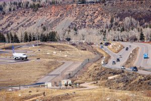
New Aspen Airport terminal design leaves room for gondola
The new Aspen/Pitkin County Airport terminal design is proposing less passenger holding space, less parking and less employee amenities, but is including space for a proposed gondola system from Brush Creek Park and Ride to Aspen.