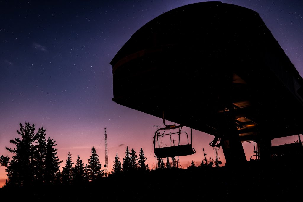
Colorado’s new stargazing trail highlights night skies across the Western Slope
The Colorado Tourism Office’s free stargazing trail map marks 13 certified International Dark Sky locations, with more on the way

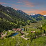
Austin Colbert/The Aspen Times
A new trail map is improving access to one of Colorado’s most unique attractions: the night sky.
The free stargazing map is not only encouraging more communities to reduce their light pollution, it could also bring more tourism to the Western Slope.
The Colorado Tourism Office unveiled the project on Tuesday as part of Colorado Dark Sky Month in June, a month designated to raise awareness of the state’s light pollution, according to a news release from the tourism office.
The Colorado Stargazing Trail offers a guide to the state’s certified International Dark Sky locations, where constellations are most clearly visible. On top of providing an incentive for proper stewardship of Colorado’s outdoor environment, Tourism Office Director Tim Wolfe said he hopes the map will draw visitors — both in and out of state — to some of the state’s hidden gems.
“Colorado has so many amazing assets, and I think this trail just kind of summarizes the opportunities,” Wolfe said. “Stargazing is certainly accessible and can be done by anybody. But, experiencing it personally with my kids, I know it’s made a difference in how they look at Colorado and the world. So we thought that putting this all under one trail will help people see the different opportunities all over Colorado, and in so many rural communities as well.”
The Colorado Tourism Office began working on the map roughly one year ago, though Wolfe said the idea came about more than half a decade ago.
“It started as a seed after COVID, (when we were keeping) social distancing in different types of experiences … It wasn’t until that time that we were like, ‘Okay, what are other things that we can do in rural communities, or things that people would like to experience?'” Wolfe said. “We invested in small amounts to help these communities get the certification, and then we said, ‘Okay, now that we got a bunch of them, how do we put it together so that people know that this is a terrific opportunity around the state?'”
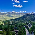
A vast majority of the map’s stargazing locations are marked along or south of Interstate 70, including Western Slope spots in Old Snowmass and Breckenridge, Colorado’s first International Dark Sky Certified ski resort town. Aside from highlighting some of the local tourism opportunities in rural western Colorado, Wolfe said he hopes the map will inspire other municipalities to pursue dark sky certifications — especially those that may already meet all the requirements without knowing it.
Colorado is currently home to 13 International Dark Sky Parks and eight International Sky Communities, with more on the way. The certified locations have proven that they have the appropriate infrastructure to meet stargazing-friendly lighting policies. Wolfe said the state currently leads the world with more than 30 locations, including 12 state parks, that are in the process of earning their certification.
“There were locations that were already there, we just needed to get it certified. There wasn’t any infrastructure and investment needed,” Wolfe said.
The tourism office collaborated with DarkSky International, DarkSky Colorado and Colorado Parks and Wildlife — which provide guidance for reducing light pollution — to achieve local certifications. Since 2023, the programs have worked with 54 partners across 32 Colorado counties.
On a global scale, Wolfe said there are 200 locations across 22 countries with International Dark Sky certifications.
The stargazing trail website also features events across the state, including tours on the Cumbres and Toltec Scenic Railroad Dark Sky Train, guided stargazing with local astronomers and ranger-led night sky programs in Rocky Mountain National Park, according to the release.
Wolfe recommends that anyone planning to visit one or multiple of the map locations should check the phases of the moon, since the brightness of a full moon can make it difficult to see the stars clearly.
“If you hit that timing right, you can see the entire Milky Way like a stripe across the sky,” Wolfe said. “I haven’t seen anything that truly puts it in perspective. … (Photos) don’t do it justice.”
The map launch coincides with Colorado’s fast-approaching 150th anniversary, which is expected to draw in visitors for numerous celebrations, festivals and exhibitions to mark the state’s birthday in August.
“We’re so excited about all of the different things that Colorado can launch on this special anniversary of the state, and to be able to add this to a number of other things that are happening around the state,” Wolfe said. “We needed to see how the communities were going to embrace the program and the process … and the timing just worked out perfect that we can launch this at the same time as our birthday.”
Clubhouse Chronicles: AVSC seniors look back on careers at ski club
With the 2025-26 winter season having come to a close, we want to congratulate and celebrate our Aspen Valley Ski and Snowboard Club seniors!

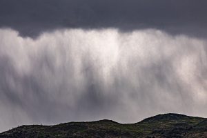
Colorado’s approaching monsoon season and El Niño conditions create hope for above-normal rainfall
Colorado is headed toward a potentially wetter-than-normal summer, with promises of an active monsoon season and growing confidence in developing El Niño conditions.