Aerial photos, data reveal traffic in Roaring Fork Valley
Local nonprofit hoping to incentivize alternative commuting with a new app

Whitton Feer/EcoFlight
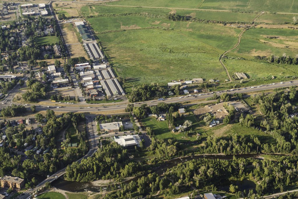
Southbound traffic on Highway 82 at 7 a.m., Thursday, July 31, was not too bad compared to some of the worst backups this valley has seen, but bottlenecks still plagued the common spots.
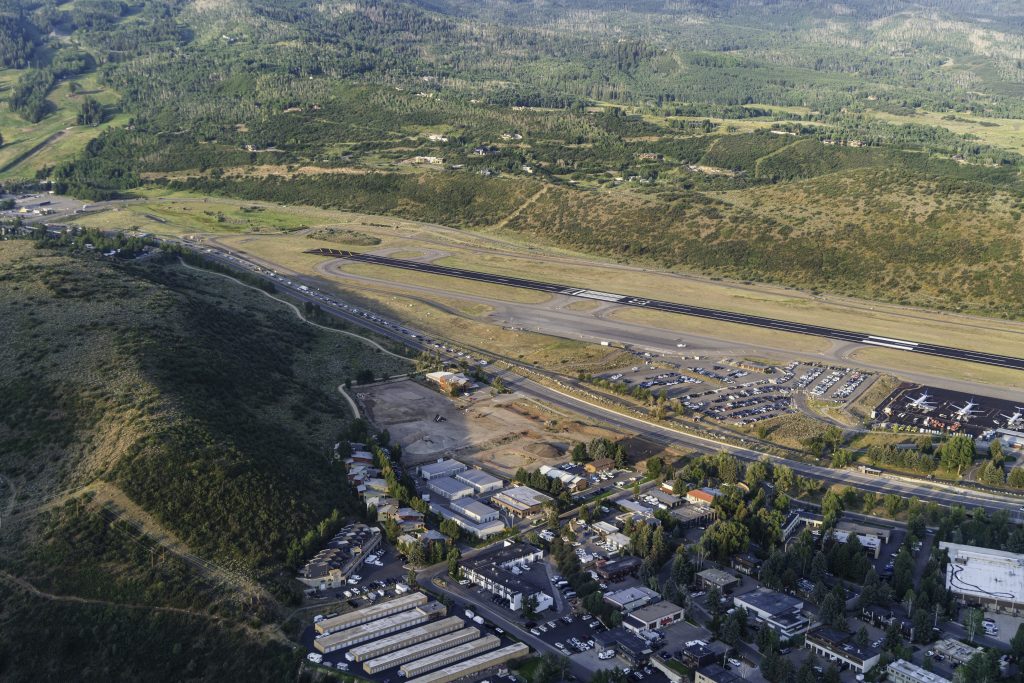
Outside the Aspen/Pitkin County Airport, a line had formed extending from south of the airport traffic light to the Buttermilk light.
Presumably, that traffic extended to the roundabout, ebbing and flowing through various sections, but from the small Ecoflight plane, the roundabout was not visible.
“Sitting in traffic isn’t fun,” Emily Williams, education and outreach manager at Clean Energy Economy for the Region, said. “We’re all trying to get somewhere, mostly upvalley. How can we make it better, are there solutions that exist to improve people’s commute? It may be that there are no solutions for you, but you also may find that you can work on the bus or read on the bus or biking a while longer, may be more enjoyable.”
EcoFlight conducts those small flights to show the human impact on the environment across the western United States. They are based out of the Roaring Fork Valley.
On Thursday, EcoFlight partnered with Clean Energy Economy for the Region, or CLEER, to capture photos of traffic during the morning rush hour. These images showed how the reduction of vehicles on Highway 82 should be a part of a traffic solution.

The traffic, while better on Thursday morning than perhaps some residents have seen it, was still striking from the air. Large clumps of cars moved together in groups clearly dictated by the release and halt of lights down the valley. Traffic slowed at Basalt and Willits, and a constant stream of vehicles slogged upvalley.
The Colorado Department of Transportation keeps permanent, continuous traffic counters in Glenwood Springs and nearby the Snowmass exit on Highway 82. According to that data, traffic in the Roaring Fork Valley has been steadily climbing for a long time.
In June 2025, Glenwood saw their highest average daily vehicle count at 29,375 vehicles per day. Many of those drivers originate in Glenwood but also travel from further down the Colorado River corridor from New Castle and Silt.
Of those commuters passing through Glenwood, many still have destinations further up the valley. The Snowmass CDOT counter counted an average of 24,442 vehicles per day in June of this year.
Over the 10 year period from 2013 to 2023, there was a 23% increase in vehicles traveling through Glenwood along Highway 82.
The consistent southbound stream of traffic was visible from the sky over Glenwood Springs on Thursday morning. Further west of Glenwood, towards New Castle, there was also a visibly consistent stream traveling toward Glenwood, eastbound on I-70.
As Aspen and Pitkin County begin the process to re-evaluate the preferred alternative, the suggestion made in 1998 for alleviating some of the traffic traveling into Aspen, commuters might have to accept that there will be no quick, infrastructure-based solution in the near future.
However, CLEER hopes they can help provide resources to people who may be able to alter their commuting habits. Hopefully by doing so, they can encourage fewer cars to travel along the Roaring Fork and Colorado River corridors.
CLEER released an app called Two Rivers Connect that provides Roaring Fork residents and commuters the ability to track their commutes and enter into prize pools that are drawn weekly by using alternative means of travel during their week.
“Our main goal with this project is to engage people into thinking about how do they get around and what are the ways that they can change how they get around,” said Williams. “Could you bike, walk, ride the bus, carpool, or vanpool?”
“There are some people for whom changing their commute is really challenging, and there are lots of other people who could potentially change how they commute,” she continued. “If everybody is able to choose an option that works best for them, whether that’s changing when or how they commute, does that make traffic better for everybody?”
CLEER is hoping that by incentivizing commuters to consider alternative ways to travel, new habits can be formed, even if it’s just for one or two days per week. The app also helps connect users with similar start and end destinations, making the potential for the creation of carpools much easier.
“It’s about encouraging people to try different options,” Williams said.

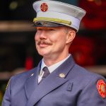
Local legacy: Aspen Fire Chief Rick Balentine retires after 36 years
Thirty-six years is a long time to work in one place. But for outgoing Aspen Fire Protection District Chief Rick Balentine, who first started volunteering with the district in 1989, his tenure was more than a job — it came as part of a long legacy of fire chiefs committed to serving the community since the District was founded in 1881.


Aspen area included in ‘release zone’ for wolverine reintroduction
The Aspen area has been included in one of three general release zones for the reintroduction of wolverines into the state, according to preliminary information from Colorado Parks and Wildlife’s developing plan.