What to expect following Aspen’s recent snowfall
Light snowfall and above average temperatures predicted in the days and weeks to come

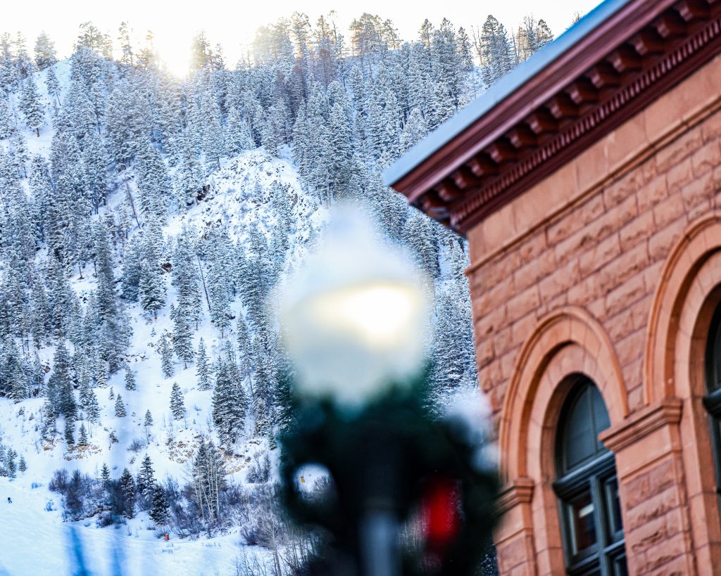
Austin Colbert/The Aspen Times
With some much-needed snowfall finally arriving in Aspen, nearly half of the total trails across the four Aspen ski mountains are open.
The mountains reported 166 out of 363 total trails open, about 46%, following nine inches of fresh snow landing on the slopes on Saturday and Sunday. But meteorologists remain uncertain about the outlook in the days to come, with intermittent snowfall and warmer temperatures forecasted.
According to the National Weather Service branch in Grand Junction, the Western Slope could see precipitation and moisture as soon as Thursday and into the weekend. It’s unclear, however, the elevation at which that precipitation would turn to snowfall, given the warmer temperatures predicted to accompany the moisture.
“So there’s still a lot of questions with what the snow and rainfall will look like later this week, so we’re not really certain when it comes to the details on potential totals yet,” Grand Junction National Weather Service Meteorologist Gillian Felton said of the weather on the Western Slope. “But it does look like there’s a chance for somewhat continuous snowfall in much of the higher terrain along the (Continental) Divide, which could potentially help the Aspen mountains.”
She said the storm system is predicted to move in from off the coast of California, bringing a “southwesterly” air flow along with the precipitation, which is generally warmer.
“And it’s quite anomalous for this time of the year,” she said of southwesterly air flows.
Felton said the weather service doesn’t yet have “a ton” of confidence about where the snowline will fall, but that freezing temperatures, which usually correlate with snowfall, will play a role in the determination.
“Our biggest question right now — where is it going to warm above freezing during the day?” she said.
As of Monday, Aspen Mountain showed a 15-inch base depth, Aspen Highlands a 30-inch base depth, Buttermilk Ski Area a 12-inch base depth, and Snowmass Ski Area a 29-inch base depth.
Looking ahead, Open Snow Meteorologist Sam Collentine said the Roaring Fork Valley could see a chance of snow around Jan. 6-7 and “likely another period of mixed weather soon thereafter.” But above-average temperatures will likely persist.
Regionally, both the eight-to-14-day weather prediction and the three-to-four-week weather prediction showed above normal precipitation and above normal temperatures for this time of year, according to the National Weather Service’s Climate Prediction Center.
On Sunday, the Roaring Fork Valley held 53% of the 30-year median snowpack, according to a graph based on 1991 to 2020 data presented by the Natural Resources Conservation Service. That puts the valley in the 3rd percentile, meaning 97% of the time, the snowpack on Dec. 28 was more substantial than it was on Dec. 28 this year, according to the 30-year data.
The center predicts this year’s La Nina weather pattern — which delivers colder and stormier weather patterns across the northwestern United States and warmer and calmer conditions across the southern United States — to end between January and March.
“This past weekend’s storm has not changed the seasonal snowfall outlook for below-normal snowfall,” Collentine wrote in an email.
Skyler Stark-Ragsdale can be reached at 970-429-9152 or email him at sstark-ragsdale@aspentimes.com.