City of Aspen confirms ‘significantly less snow’ for 2026 water management
A late March Airborne Snow Observation flight measured less than half the Snow Water Equivalent seen in 2025

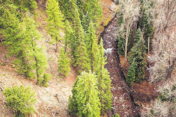
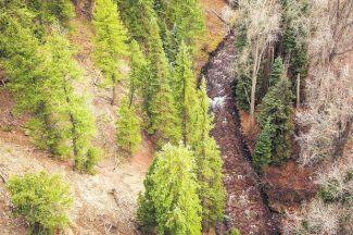
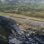
Anna Stonehouse/The Aspen Times archives
The first of two Airborne Snow Observation flights took to the sky on March 22 — weeks earlier than usual — to confirm the snow situation in Aspen’s surrounding watersheds.
The city has been participating in and funding portions of ASO flights since winter 2023/24 and is also a member of the Colorado Airborne Snow Measurement Program, whose workgroup is working toward a statewide program to conduct regular ASO flights and “provide significantly improved streamflow forecasting throughout Colorado,” according to Aspen’s Utilities Resource Manager Steve Hunter.
While the first ASO flight is typically flown April 7-14, closer to what Hunter said is median peak Snow Water Equivalent (the amount of liquid water contained within a snowpack) for the Roaring Fork watershed, this year’s low snow conditions changed things.
“Most flights were earlier this year due to below average snowpack,” Hunter said. “I anticipate our second flight, usually scheduled for the end of May … will be earlier as well. We are trying to time flights to best capture the remaining snowpack at a range of elevations throughout the basin.”
He confirmed that the March 22 flight “showed significantly less snow in the Castle, Maroon and surrounding watersheds.”
He added, “This flight was almost a month earlier than the previous year’s flight and measured less than half of SWE than in 2025, which was a below-average year. High temperatures and lack of precipitation have severely impacted these and other western watersheds this year.”
A lower SWE means a thinner, less dense snowpack overall, causing concerns for Aspen’s water supply this summer.
For the flights, the Airborne Snow Observatories, Inc. pairs airborne LiDAR and imaging spectrometer sensors with a snow dynamics model to measure snow depth and albedo — how reflective the surface is — in addition to retrieving SWE across large river basins at a “high spatial resolution,” Hunter explained.
“The resulting data provides high-elevation snowpack measurements with detail, accuracy and decision-support value in water management,” he said.
According to Hunter, these ASO flights are used to enhance understanding and quantify the amount of SWE in the Castle and Maroon Creek watersheds. They also provide detailed hydrologic stream runoff and timing forecasts.
“This can help us anticipate, plan and manage water during drought,” he said, in addition to helping the city’s water treatment staff manage the treatment of water, particularly during runoff.
PJ Murray, project manager for the city, added that water managers rely on the hydrological data to forecast snowmelt runoff, seasonal river and reservoir inflows and soil moisture.
The Clean River Program, which is also called the Stormwater Program, is what primarily addresses water quality and quantity in the Roaring Fork River, according to Murray, and also contributes funds to the Independence Pass/Upper Roaring Fork watershed. The City Water/Utilities Department helps fund the flights for Castle and Maroon Creek Watersheds since those are the primary sources for Aspens drinking water.
“The city’s water supply comes primarily from snow that falls in the Castle & Maroon Creek watersheds,” Hunter shared. “ASO better spatially captures the amount of SWE basin-wide at all elevations. This, along with stream forecasts and timing, is critical to water management for the utilities department.”
The Clean River Program uses the data to help shape expectations of how urbanization could affect local rivers, minimize negative impacts and prioritize efforts.
“Understanding how much water is stored in the upper watershed’s snowpack helps assess potential river stress due to low water levels,” Murray said. “While opportunities to increase water quantity are limited, monitoring the snowpack enables the city to manage resources as effectively as possible, for example, adjusting diversion timing or collaborating with partners across the valley to support minimum instream flows.”
The reduced snowpack and lower flows that are anticipated this summer also means that any pollutants reaching rivers from the city — including construction site sediment, illicit discharges of materials other than stormwater into storm drains and debris accumulation in streets — will have what Murray called “heightened impact.”
Observed illegal dumping into rivers or storm drains or suspicious conditions should be reported via the Aspen311 app.
City of Aspen confirms ‘significantly less snow’ for 2026 water management
The first of two Airborne Snow Observation flights took to the sky March 22, weeks earlier than usual, to confirm the snow situation in Aspen’s surrounding watersheds.

Aspen Snowmass introduces new Pass options for 2026/27 winter season
Aspen Snowmass has expanded its offerings of Passes for the 2026/27 winter season, with new flexibility, broader access and loyalty appreciation going live on Wednesday.