Take a hike: Here’s 10 options in Aspen and Glenwood

Aspen Times file photo |
A summer visit to the Roaring Fork Valley wouldn’t be complete without a hike, the simplest and most universal way to enjoy the Rocky Mountains in the warm months.
Here are 10 worthy walks located close to the valley’s main hubs of civilization – Aspen and Glenwood Springs. They are arranged in order of difficulty, from easy to difficult, but take note of each hike’s length and elevation gain for a fuller picture.
For a wider selection of trails, including those in the midvalley near Basalt and Carbondale, visit any local bookstore or outdoor/mountaineering store for maps, guidebooks and more information.
A few things to remember about hiking in the mountains: Sunscreen, sunscreen, sunscreen. Also, the weather can change rapidly from sunshine to cold and nasty, so carry appropriate clothing. Sleet, hail and even snow are possible at high elevations, even during the summer. If threatening weather develops, turn around. Exposed areas are the wrong place to be in a lightning storm.
In general, early morning is the best time to start a long hike, as thunderclouds may develop in the afternoon. There are, of course, no guarantees.
The Grottos Trail
Length: 1 mile, depending on route
Elevation gain: Minimal
Trailhead: From downtown Aspen, head east on Highway 82 toward Independence Pass. After 9 miles, the Weller campground will be on the left. Continue for another 0.9 miles to the Grottos Day Use Area sign on the right.
Rating: Easy
Description: This is a great choice for families with curious kids, who will love the rock formations and natural water features. It’s really more of a short, relaxed exploration than a hike. From the picnic area on the Roaring Fork River, cross the footbridge and turn left, heading uphill past granite slabs to the Ice Caves, where water and ice have carved deep, swirling channels and caverns into the rock. Kids will find these narrow, twisting slots hard to resist, but parental supervision is advised. Beyond the Ice Caves, the trail continues to a series of roaring cascades and waterfalls that make fine picnicking and picture-taking spots.
Doc Holliday’s Grave
Length: 1 mile round trip
Elevation gain: 300 feet
Trailhead: From downtown Glenwood Springs, the trailhead is at 12th and Bennett, which is three blocks east of Grand Avenue.
Rating: Easy
Description: This short trail winds up a hillside to the historic pioneer cemetery established in 1886. From the cemetery, hikers get a tall view of the town and can wander around looking at the old headstones. Somewhere in this cemetery is the grave of John Henry “Doc” Holliday, the former gunslinger who came to Glenwood Springs hoping to be cured of tuberculosis, and the grave of Henry Logan, better known as the train robber “Kid Curry.” This is a great trail for families with small children or older folks.
Maroon Lake Scenic Trail
Length: 1.2 miles round trip
Elevation gain: 120 feet
Trailhead: Unless you arrive early in the morning, summer access to Maroon Lake is restricted to shuttle buses only. Buses run from Aspen Highlands Village off Maroon Creek Road. Call 970-925-8484 for information on schedules and fares.
Rating: Easy
Description: Maroon Lake, with its iconic view of the famous Maroon Bells, is one of the easiest, shortest and most popular hikes in the Aspen area. The 1.2-mile, out-and-back trip on the lake’s northwestern side leads to an active beaver pond, and is a worthy pursuit all by itself. But Maroon Lake is also a major gateway to the vast Maroon Bells-Snowmass Wilderness Area, and everything from half-day walks to multi-day backpacking and climbing trips begin here. For more ambitious day hikes from this starting point, consider Crater Lake (3.6 miles round-trip), Buckskin Pass (9.6 miles round-trip) or, for die-hards and wildflower-lovers, the trek over 12,500-foot West Maroon Pass to Crested Butte (11 miles, shuttles to CB available on the far side).
Grizzly Creek Trail
Length: 7 miles round trip
Elevation gain: 1,700 feet
Trailhead: From I-70 in Glenwood Canyon, take Grizzly Creek exit 121. The trailhead is accessible from the lower and upper parking lots.
Rating: Easy
Description: The trail climbs gently along Grizzly Creek, offering many viewpoints of a beautiful mountain stream cascading down through a rocky streambed, and plenty of spots for anglers to try casting. The first 1/4 mile to an old-time picnic spot is wheelchair accessible. Beyond there, the trail climbs more steeply through the site of a 1958 forest fire. The trail ends at the city of Glenwood Springs water diversion structure.
Hunter Creek Trail
Length: 6 miles
Elevation gain: 820 feet
Trailhead: From downtown Aspen, drive north on Mill Street, cross the Roaring Fork River, bear left briefly on Red Mountain Road and turn right on Lone Pine Road. Look for the trail sign on the left-hand side of the road.
Rating: Moderate
Description: Hunter Creek is known as Aspen’s “back yard,” thanks to its accessibility from town, but this enjoyable climb along a rushing mountain stream and into a broad, grassy valley takes hikers to another world. From the trailhead, the path climbs steadily, crossing multiple bridges over Hunter Creek before crossing the U.S. Forest Service boundary and entering the rock-studded meadows of Hunter Creek Valley. A branch to the left crosses over the Tenth Mountain Bridge and leads to several mining-era cabins. Continue up the valley past the cabins and cross back over the creek in another mile or so. From this bridge, the trail loops back to the main path, and you can retrace your steps to Aspen. Multiple spurs and side-trails are available to those with maps and extra water.
Hanging Lake
Length: 2 miles round trip
Elevation gain: 1,000 feet
Trailhead: From eastbound I-70, take Hanging Lake exit 125, drive 1/4 mile to the Hanging Lake Rest Area parking lot. From westbound I-70, motorists must drive to the Grizzly Creek Rest Area, turn around and drive back to the Hanging Lake exit. Walk 3/8 mile on the level, paved Canyon Trail to the trailhead. Dogs not allowed.
Rating: Moderate
Description: This popular trail climbs up along Dead Horse Creek, crossing seven footbridges on its steep route to the beautiful travertine lake. A few level stretches and shaded benches give hikers a place to rest. The final push to the lake is a set of steep stairs hewn into the rock. A boardwalk extends around the lake, giving a view into the turqoise-blue waters of native cutthroat trout. Waterfalls cascade into the lake through mossy overhangs. For an extra thrill, follow the Spouting Rock Trail above the lake to see water gushing straight out of a hole in the limestone cliff and enjoy the cooling spray.
Scout Trail
Length: 3 miles round trip
Elevation gain: 2,000 feet
Trailhead: From downtown Glenwood Springs, walk east up 8th Street. Just before the last house, look for a sign pointing left to the Scout Trail.
Rating: Moderate
Description: For a quick route to expansive views of Glenwood Springs and the Flat Tops, the Scout Trail is a natural. The trail climbs up a gully and then contours east, swinging out onto dry hillsides and then ducking back into an oasis-like gulch. After heading to another outlook, it makes a beeline for the summit of Lookout Mountain. Below the summit, the Scout Trail intersects with the Bear Creek Trail, which takes hikers along the south rim of Glenwood Canyon. Take a map to avoid confusion about your route.
Cathedral Lake
Length: 5.6 miles round-trip
Elevation gain: 2,000 feet
Trailhead: From downtown Aspen, take Main Street/Highway 82 west to the roundabout, and follow the Castle Creek spur past Aspen Valley Hospital and up the valley for 12.2 miles. Shortly after the ghost town of Ashcroft, turn right onto a gravel road, and drive a half-mile to the parking area.
Rating: Difficult
Description: Nestled amid 13,000- and 14,000-foot peaks high above the Castle Creek Valley, Cathedral Lake is one of Aspenites’ favorite half-day hiking destinations. This trail climbs through beautiful aspen forests to the wilderness boundary before getting steeper as it follows Pine Creek. After leveling off briefly, the path continues steeply through spruce forests, past rockslides and up some short, steep switchbacks. Bear left at all forks. The trail will cross Pine Creek on a bridge before reaching the lake. From the lake, many hardy hikers backtrack to an earlier fork in the trail and then head north through fields of wildflowers to 13,500-foot Electric Pass, for thrilling views of Conundrum Valley and the surrounding Elk Mountains.
Storm King Mountain Memorial Trail
Length: 2 miles round trip
Elevation gain: 600 feet
Trailhead: From I-70 west of Glenwood Springs, take Canyon Creek exit 109. Follow the north frontage road east one mile to the trailhead parking lot.
Rating: Moderate
Description: This trail pays tribute to the 14 firefighters who perished on this mountain in the Storm King Fire on July 6, 1994. The trail is deliberately rugged, with steep slopes and unstable footing to give visitors a sense of the conditions firefighters work in. The trail climbs steeply up a slope and onto a ridge for 1 mile to an observation point. From here, a more primitive trail drops into the gully and then makes a steep climb to two locations where firefighters died. A memorial to the 14 firefighters is also located at Two Rivers Park in Glenwood Springs.
Lost Man Trail
Length: 9 miles total
Elevation gain: 2,300 feet
Trailhead: From downtown Aspen, head east on Highway 82 toward Independence Pass. Pass the lower Lost Man trailhead at 14 miles (across from the Lost Man campground), continuing on to the big switchback at 18.5 miles, and park on the left. The recommended route leaves from this point and ends at the lower Lost Man trailhead, four miles down the road. (Hikers can leave a shuttle car at the lower trailhead, or hitchhike back to their car.)
Rating: Difficult
Description: This semi-loop involves either a car shuttle or a short hitchhike, but it passes two beautiful alpine lakes near the Continental Divide and meadows full of wildflowers, with 13,000-foot peaks on all sides. From the upper Lost Man trailhead, the trail climbs for roughly two miles to Independence Lake, surrounded by boulders and fields of flowers. A steep climb follows to the saddle at 12,800 feet. Follow the cairns down to Lost Man Lake, then continue down the rocky, steep-walled valley for two miles to the junction with the South Fork Trail. Go left here. At the 7-mile mark, the trail crosses a creek, and Lost Man Reservoir is about a mile ahead. Beyond the reservoir, the trail splits; stay straight and cross the wooden bridge to the lower Lost Man parking area.
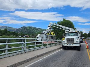
CDOT shares annual outlook with Pitkin County
The Colorado Department of Transportation shared updates at Tuesday’s Pitkin County Board of County Commissioner’s work session on projects completed in 2025 and future plans for the region.