Hidden in high-elevation trees, Colorado’s SNOTEL stations collect crucial data amid one of the worst snowpacks on record
Colorado’s snowpack data is used by multiple industries, including agriculture and recreation, and helps predict spring streamflow and summer fire risk


Ryan Spencer/Summit Daily News
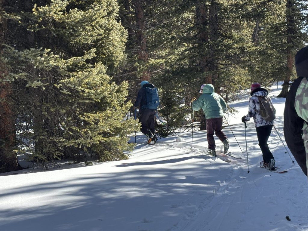
Tucked off the beaten path, one of Colorado’s snow telemetry (SNOTEL) stations goes largely unnoticed nestled in the trees along the Continental Divide south of Breckenridge.
All year long, gadgets in the ground and suspended on poles in the air gather data about the weather and precipitation that is used by thousands of Coloradans and water managers across the West.
“Snow survey started in the 1930s here in Colorado because agriculture is a really large driver in the Western United States. About 80% of the water that we use in the Western U.S. goes to agriculture,” Colorado Snow Survey Hydrologist Brian Domonkos explained. “So, in 1936, Congress recognized that it was important to measure snow because the correlation and connection to agriculture was pretty big.”
The Colorado Snow Survey, a program of the U.S. Department of Agriculture’s Natural Resources Conservation Service, monitors and maintains 184 SNOTEL sites across Colorado, Arizona, New Mexico, and southern Wyoming, Domonkos said. He noted that the snow survey is based out of Lakewood and that he is one of seven team members who helps monitor and maintain the telemetry stations.
Annually, between 50% and 80% of the water used in the West comes from mountain snowmelt, underscoring the importance of the snowpack levels, he said. He noted that the system also provides data that is used by Colorado’s recreation industry, including by backcountry skiers, rafters, and anglers.
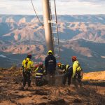
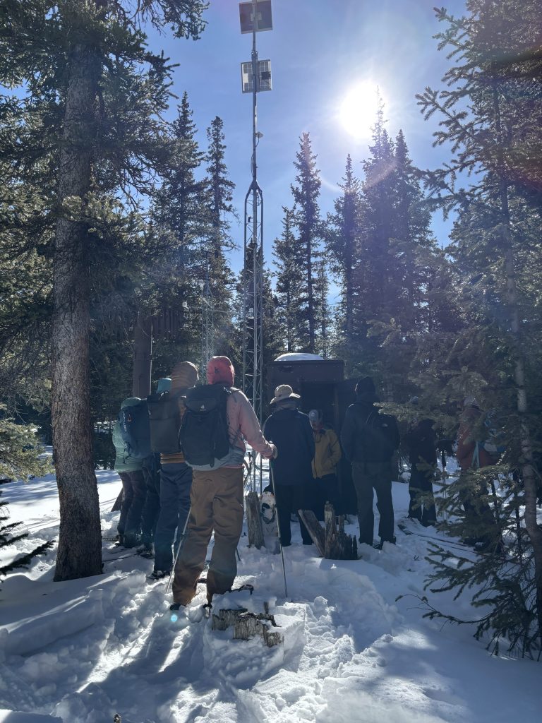
Surrounded by about a dozen people wearing snowshoes and backcountry skis, Domonkos spoke from the parking lot atop Hoosier Pass at 11,542 feet on Thursday, Feb. 5. After introductions, he led the group into the woods, where he described how the SNOTEL system works and the types of data it collects.
“I’m really excited that everyone is out here and interested to learn about snow in a year where we’re almost epicly low for snow,” he said, noting that several of Colorado’s snow telemetry stations have recorded record-low snowpack conditions this season.
How do Colorado’s SNOTEL stations work?
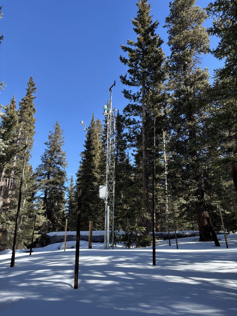
As Domonkos led the group off the trail and into the trees, the snow grew slightly deeper, which he said is exactly why this spot was chosen as the location for a SNOTEL station. These stations are typically located on high-elevation mountain passes in the trees, where more shade allows the snow to be less impacted by the sunlight and wind, he said.
“These SNOTEL stations are placed in locations that are going to represent the snowpack for the area — that are going to be the driver for runoff,” Domonkos said. “So we put these sites in an area that is representative of the greater basin and actually has a good statistical correlation with the stream gauges down below.”
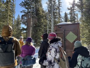
He noted that snow telemetry stations are federal government property, and it is illegal to tamper with them. He said members of the public should remain at least 50 feet away from them, so as to not interfere with the data collection.
At each SNOTEL station, the “primary, most important sensor” is a fluid-based scale that is buried under the snow in the winter, he said. Known as the “snow pillow,” this scale is pushed down by the snow that builds up on top of it. The amount of pressure on the snow pillow pushes fluid through a tube that corresponds to the amount of water in the snow, or the snow-water equivalent, he said.
“So how much water do you think is on the snow on that pillow right now?” Domonkos asked.
Guesses rang out from the group: “2.5 inches?” “3 inches?”
About 4.2 inches, Domonkos said. He noted that if he were to melt down the snow on the pillow, that’s how much water he would expect there to be.
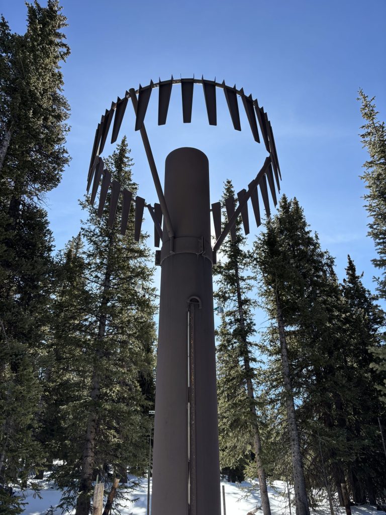
Pointing up at a turquoise-colored sensor on a pole, he explained that each snow telemetry station is also equipped with a snow-depth sensor. This sonic sensor emits “clicks” that bounce off the snow and are re-received by the sensor. The sensor can then use the time between clicks to calculate the depth of the snow, he said.
Each telemetry station also has a precipitation gauge, which measures all types of precipitation, including rain, sleet, and snow, as it falls, according to Domonkos. Because Colorado’s dry conditions result in snow that is often very light, he said precipitation gauges are outfitted with an “altershield” — or a circle of metal plates that swing in the wind — to slow the wind down, so that snow doesn’t get blown out of the gauge.
Finally, each station also has air-temperature and wind-speed sensors, and many stations also have soil-moisture sensors buried underground at 4, 8, 20, and 40 inches of depth that are constantly measuring the soil temperature, moisture, and salinity.
All the data collected by the sensors is fed to a memory card in a shelter and transmitted to the Colorado Snow Survey program in Lakewood via cell signal, or at sites without cell signal using satellite connection, Domonkos said. In Colorado, these shelters are 8 feet tall, but in some states, they have to be built up to 30 feet tall in order to be accessible during heavy snow years.
Some winters, he said that he has to do quite a bit of digging to access the shelter, but “this is not one of those years.”
Poor snow year
According to Colorado’s snow telemetry systems, the snowpack this year is the worst on average compared to the 30-year period between 1991 and 2020.
But while the SNOTEL system only has data going back until about 1980, he pointed back to the snowpack data that has been collected manually in the state since the 1930s, through a technique called snow courses.
Because the snow course data has a longer record, he said it shows two winters — 1976-77 and 1980-81 — when the snowpack appears to have been worse than this year, at least in some river basins.
“At one point, some of us were starting to say we’re looking at the lowest snowpack on record this year,” he said, “But the (National) Weather Service was saying, ‘Hey, maybe it’s not the lowest snowpack we’ve ever seen.'”
Using a large metal pipe that he pushed into the snowpack, Domonkos then weighed to estimate the amount of the water in the snow collected in the tube, demonstrating how snow course data has been collected for nearly 100 years. Across the state, snow course data is collected at 70 sites on the first of each month, he said.
After analyzing 30 snow course sites with annual data going back to 1944, he said he concluded that during the winter of 1980-81, the snowpack was “really, really low — semi-considerably lower than we are right now.”
While that winter had a snow-water equivalent that was about 1 inch lower than this winter as of Feb. 1, he said that some reprieve came in March 1981, when heavy snow fell across Colorado.
“To stay above 1981, at least in March, we’re going to need some decent snow,” Domonkos said. “I think we calculated about 140% of normal (precipitation) in March 1981. Hopefully, we’ll see levels like that.”


Jazz Aspen Snowmass announces Labor Day lineup
Jazz Aspen Snowmass has released its line-up for the 2026 JAS Labor Day Experience, bringing together a mix of global superstars, breakthrough artists, and fan favorites for an unforgettable weekend of music.