A not-so-white Christmas: Colorado mountain towns saw rain, record-high temperatures and record-low snowpack
Leadville, Breckenridge, Keystone and Aspen all experienced small amounts of rain on Christmas Day, according to the National Weather Service


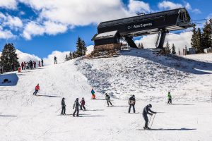
Austin Colbert/The Aspen Times
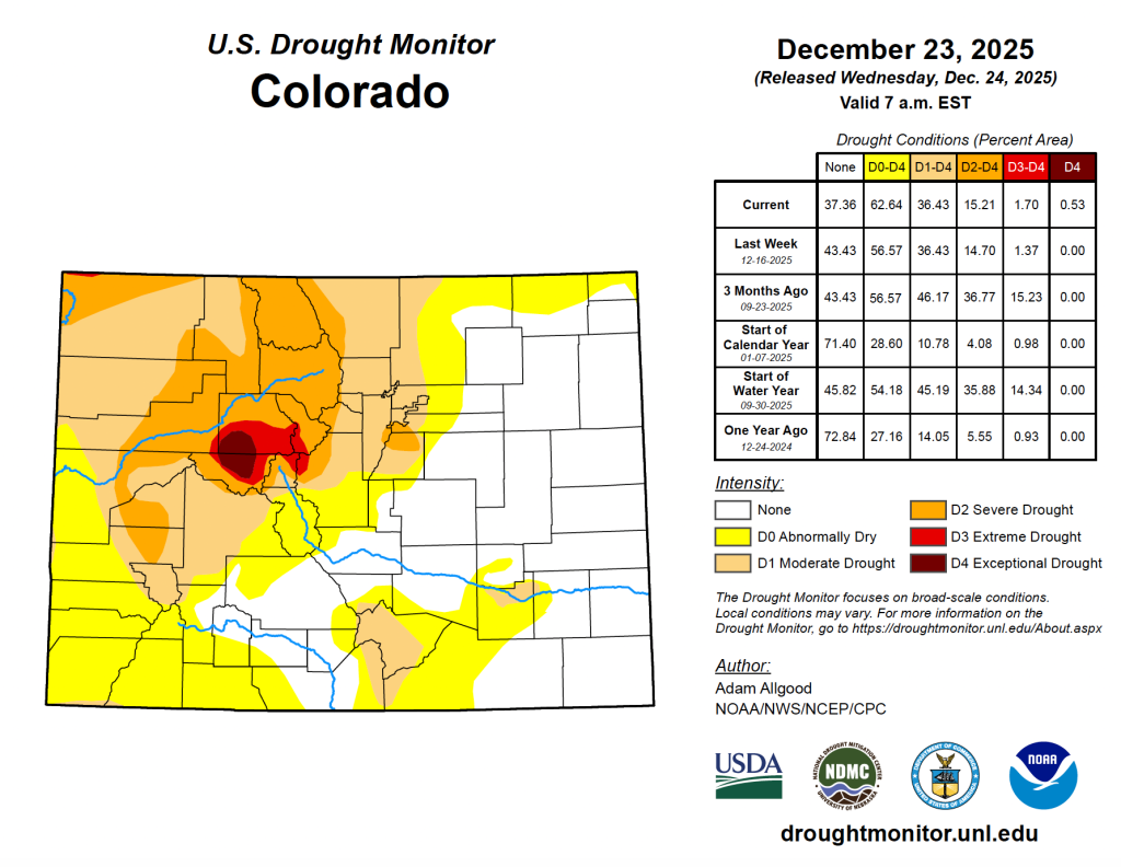
Across Colorado, this Christmas holiday was not particularly white, as many mountain towns saw small amounts of rain, record-high temperatures and a record-low snowpack.
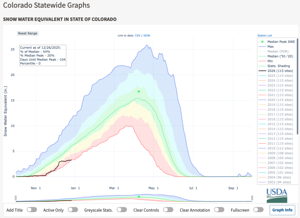
As of Dec. 25, Colorado’s statewide snowpack stood at just 3.2 inches of snow-water equivalent and had reached the zeroth percentile, or its lowest point in at least the past 30 years, according to the U.S. Department of Agriculture’s snowpack telemetry, or SNOTEL, system.
“The winter of 1976-77 is generally thought to be the worst snow year in our mountains but the SNOTEL network wasn’t built out yet at that point, so it’s hard to make direct comparisons,” Colorado Climatologist Russ Schumacher said. “But the fact that we’re even in the same conversation with that winter is not good news.”
Out of the 94 SNOTEL stations in Colorado with at least 20 years of data, 22 of them were at a record-low snowpack on Christmas Day, and 10 were at their second-lowest snowpack on record, Schumacher said. He noted that warm temperatures and a lack of storms throughout December has not helped the state’s snowpack.
Temperatures over the Christmas holiday were approximately 15 to 25 degrees above normal across the mountains, National Weather Service Grand Junction Office meteorologist Braeden Winters said Friday. The streak of unseasonably warm weather began toward the beginning of December and continued to get warmer through the holiday period.
In Dillon, a weather station smashed the all-time daily record-high temperature on Christmas Day, recording a temperature of 54 degrees Fahrenheit, according to the National Weather Service. That’s five degrees warmer than it has been at that station on Christmas in over 100 years, with the previous record being a tie between 1919 and 1971, when temperatures on Dec. 25 were 49 degrees.
The winter of 1980-81, another warm and dry winter, holds the record for having the warmest December in Colorado history, Schumacher said, “but it looks like a good bet that this year will top it.”
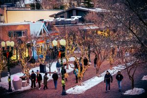
Rather than white, fluffy flakes for Christmas, Colorado’s mountain towns — including Leadville, at 10,154 feet, Breckenridge at 9,600, Keystone at 9,280 feet and Aspen at 7,891 feet — experienced light rain and mixed precipitation on Thursday.
“We got reports of rain, especially yesterday, in the mountain valleys,” National Weather Service Boulder Office meteorologist Russell Danielson said on Friday. “We don’t have great data on how rare that is but we can say it’s pretty darn rare to get rain above 8,000 to 9,000 feet in December, especially right around the shortest day of the year.”
The small amounts of rain, which totalled just a tiny fraction of an inch, did little to improve the drought conditions present across Colorado’s Western Slope. Exceptional and extreme drought conditions are present in Eagle and Pitkin counties, with extreme drought pushing into Summit County and moderate-to-severe drought spreading across the northwest corner of the state, according to the U.S. Drought Monitor.
Winters noted that it’s hard to say what impact the rain had on the snowpack.
“With our snowpack already being pretty weak as it is, the rain can definitely erode away what there is,” Winters said. “With it being so hot across the region, the hot temperatures are hurting the snowpack as it is. So, it’s hard to say how much of that is attributable to the heat versus these rain on snow events, but it certainly doesn’t help.”
After the warm, dry Christmas holiday, the forecast is finally calling for colder temperatures and snowfall heading into the weekend. Danielson said snow is expected to start falling in the Steamboat Springs area on Friday night before pushing southward into the north and central mountains along the Interstate 70 corridor.
Steamboat Resort and the Park Range could see more than a foot of snow, while ski resorts in Summit, Grand, Eagle and Pitkin counties could see moderate amounts of snow in the 6 inch range to over a foot, depending on the elevation, Danielson said. He noted that temperatures are forecast to get significantly colder on Sunday, generally in the low teens in the mountain valleys and the single digits in the peaks.
For a “glimmer of hope,” Schumacher said he is looking at the winter of 1999-2000, which had the lowest snowpack in late December “in the SNOTEL era.” That winter the peak snowpack ended up being “pretty close to average” thanks to a huge amount of snow in February and through the spring, he said.
“There is still a long way to go in the snow accumulation season,” Schumacher said. “The mountains will see a decent storm Saturday, but at this point we will need a whole lot of big storms to get back anywhere close to average.”


Aspen One confirms skier death on Aspen Mountain
A skier died on Aspen Mountain Friday following a collision with a tree, according to a statement released by Aspen One’s communications team.