What was that mushroom cloud formation seen from western Colorado on Monday evening?
Lone thunderstorm cloud was hanging out over Fairplay
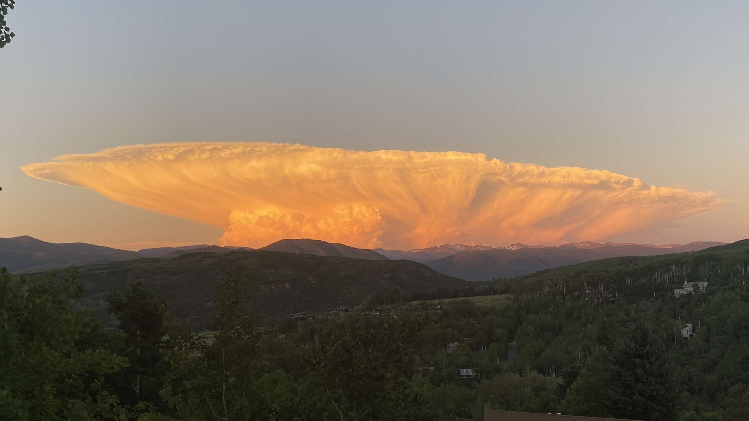
Social media sites exploded with activity Monday night as locals posted pictures of a mushroom cloud formation visible from most of Pitkin, Eagle and Garfield counties.
Meteorologist Dennis Phillips was able to provide a quick answer: Phillips said locals were enjoying the one storm cloud that was hanging out over Colorado.
“There was a thunderstorm all by itself, hanging out over Fairplay,” Phillips said Monday night after seeing pictures of the cloud.
Phillips said light wind loft was creating the mushroom effect.
“The stem part of that mushroom is the updraft of the thunderstorm, so all that air is getting thrown upward, and it has to spread out, and when the winds are really light aloft, it can spread out in all directions,” Phillips said.
Phillips said the elevation of the storm also could be contributed to the mushroom cloud effect. The top part of the cloud was at an elevation of about 36,000 feet.

“Once it gets up there around 36,000 feet it kind of hits a ceiling, and it just starts spreading out, and since the winds are so light, the clouds are going in all directions, a circular pattern,” Phillips said.
Meterologist Joel Gratz with opensnow.com described the large cumulonimbus formation it as a typical thunderstorm cloud.
“This one happened to be very photogenic with light from the sunset and no other clouds around competing for attention,” he said.


